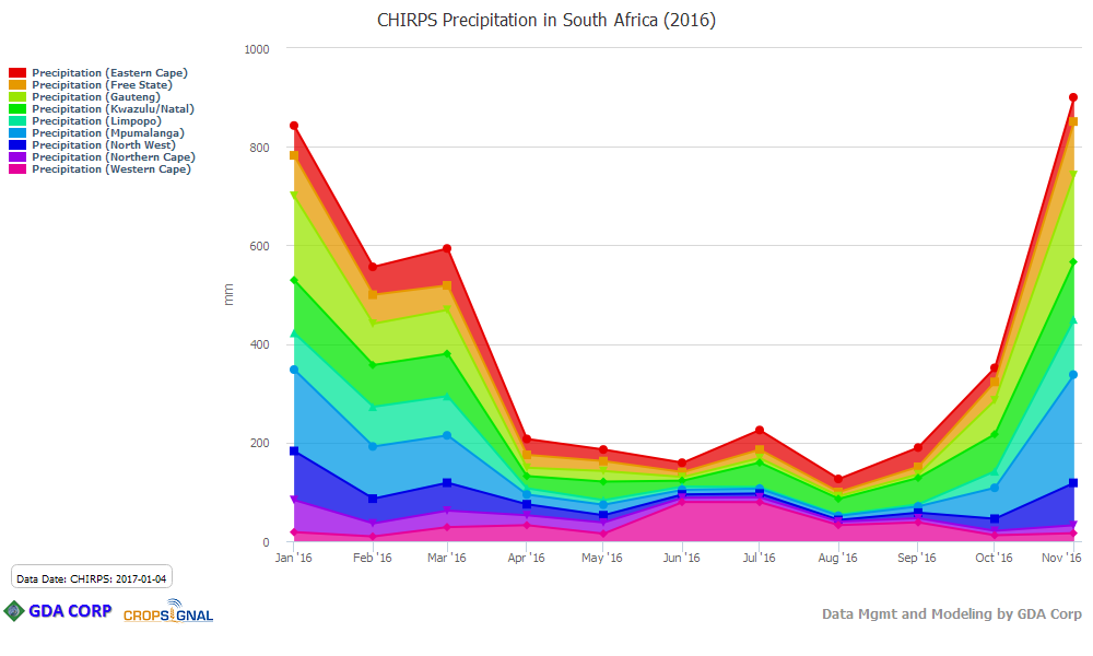
GDA has added precipitation data at L1, L2, and L3 levels from CHIRPS. CHIRPS precipitation is a continuous raster dataset that has been subset by administrative unit geographic boundaries and also filtered to known croplands. The precipitation anomaly and SPI data has been provided as well. The Weather Topic has been modified to support this data with the addition of a data source dropdown. New time periods have been added to support this including Dekad and 2-monthly and 3-monthly.